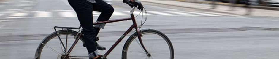
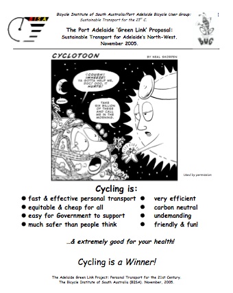
 Origins: Establishing a long distance, ‘low stress’ City-to-Port Bicycle Route – away from arterial roads & linked to the Outer Harbour rail corridor and local bike networks – has long been on the agenda of the Port Adelaide Bicycle User Group. Our focus on a Greenway between The Port and The City really started to come together with a way-finding ‘saddle survey’ we undertook in August 2005. We put together an illustrated proposal for a Port-City Green Travel Corridor or ‘GreenLink’. This was provided to the PA/E Council & to Patrick Conlon, the Transport Minister of the day in the Rann Labor Government. This proposal identified the route’s potential as well as some of the specific challenges involved.
 With the Bicycle Institute of S.A. we recommended that this Port-City GreenLink route be incorporated into a broader Adelaide Greenway Network plan, with several suggestions for such routes. An initial Network Plan was published in SA’s 2006 ‘Safety in Numbers (2006-10)’ bicycle strategy. PortBUG’s GreenLink proposal was also adopted as a major focus for the Port Adelaide/Enfield Council’s first Local Area Strategic Bicycle Plan (2008-12).

Labour State Transport Minister Pat Conlon was interested in cycling & had his own vision for a Greenway Network across Adelaide. In 2010 the S.A Labour Party published a ‘Greenways and Cycle Paths Policy’ to stimulate local government agendas. A more detailed vision for Adelaide’s Greenway Network subsequently appeared in SA’s ’30 Year Plan for Greater Adelaide’, also linked to Government transport, housing, health & economic development policies.
The Proposed Route: The proposed route for the Outer Harbour Greenway – particularly between the City and Port Adelaide – followed the Outer Harbour rail reserve & PortBUG’s original 2005 recommendations. The route is not on the rail reserve itself but follows the rail alignment on nearby pathways, adjacent local roads & on public parklands where available. The PortBUG recommended this approach wherever possible to:
- minimise costs & maximise access
- get the route established quickly & then…
- assist further refinement over time.
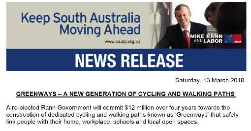
Premier Rann announces Greenway Project funding.
Funding: In 2010 Premier Rann announced a four year funding package of $12M for a city-wide Greenway Project (2010-13) with initial work focussing on Greenways to the south of the CBD & to Glenelg.
In late 2012 the Dep’t for Planning, Transport & Infrastructure (DPTI) informed the BUG that the Outer Harbour Greenway would be ‘next on the list’ and indeed, its development started to take shape over 2013. Development since then has largely been the responsibility of DPTI with responsibility gradually devolving to the two Councils primarily involved – City of Charles Sturt and Port Adelaide/Enfield. Additional funding has subsequently also been provided as part of major projects at St Clair, Croydon (‘Torrens2Torrens’) and Bowden (‘Torrens Junction’ and the ‘Retort House Development’).
New Infrastructure: New infrastructure includes:
- a steel bike bridge installed by the Charles Sturt Council at Rosetta Street
- four new bicycle and pedestrian activated (BPA) road crossings (Semaphore Road, Cheltenham Parade, Woodville Road and David Terrace)
- several hundred metres of new shared-use pathway (SUP), at Rosewater, St Clair, Woodville, Croydon & Bowden
- new bike/pedestrian overpasses at Chief St & South Road
- a major new underpass at Park Terrace & Bowden Rail Station Precinct
- many new ramps, short linkages, ramps & crossing access pathways
- new lighting at Rosewater, St Clair, Croydon and Bowden
- consistent advisory & destination signage along the route.
Rebuilding and resurfacing of existing pathways has occurred at several points including Alberton & Rosewater. Some ‘bike friendly’ Automatic Rail Crossings have been installed – these will facilitate bike access to the Greenway & also improve crossing safety for people using mobility devices & wheelchairs). Significant Greenway access has also been provided by the Renewal SA’s new ‘Harbour Loop’ pathway around the Port’s Inner Harbour & across the Birkenhead Bridge and by complementary pathways provided by PA/E Council along Semaphore Road.
The Greenway North of ‘The Port’: In early 2017 additional works completed most of the Northern sections of the Outer Harbour Greenway (linking The Port to Outer Harbour) by providing off-road bike path linkages and signs to link local roads. New road crossings and signed Greenway links have also been provided through the waterfront precincts in the Port.

New Bicycle Overpass at South Road.
A New Overpass at South Road: At the City end of the OH Greenway the Torrens-to-Torrens project at South Road has provided a major new bikeway overpass and extended pathway extending through the Retort House Development to East Street. This overpass has been a major step in the completion of the Greenway as a continuous and effective cycling route.
Linking to the Park Lands: Between East Street and the Adelaide Parklands a new on & off-road bikeway passes along Drayton St, through the Bowden Rail Station precinct and then under Park Terrace to emerge in the Adelaide Parklands where cyclists can join the Parklands bike network.
Completion: The last remaining section (about 150 metres of pathway between the new Chief Street Bridge and East Street) was completed in early September, 2019 with a community-driven ‘BikeFest’ held on 13th October to celebrate the event. The OHG was a complex project & took 14 years to complete. It involved the negotiation of:
- new off-road shared-use pathways through development sites at St Clair & Bowden
- inclusion of major bicycle infrastructure – a new overpass & underpass with extended ramps at South Road & Park Terrace, a new bridge at Chief Street & 5 new light-controlled crossings and access pathways at main road crossings.
- significant redevelopment & upgrading of existing pathway & underpass infrastructure at Gilman, Rosewater & Alberton.
Completion of the OH Greenway – made possible by the continued commitment & interest of:
- major State & Federally funded projects
- the Cycling & Walking Directorate within DPTI
- PA/E and CCS Councils
- the Port & Westside Bicycle User Groups and…
- all of the communities involved.


Is there a map of the greenway anywhere?
LikeLike
Hi KB,
There is a rather indistinct map available in a Labour Party policy document here: http://yooyahcloud.com/BIKESA/IXzZl/Labour.pdf
Note that for some reason the map on page 8 doesn’t show the Grange section of the Greenway!
In the 30 Year Plan for Adelaide, Section D there are multiple text references to the Greenways – see: http://www.dplg.sa.gov.au/plan4adelaide/html/files/plan/07a_Chapter_D.pdf
& the maps pages 5 – 13.
&
http://www.dplg.sa.gov.au/plan4adelaide/html/files/plan/07c_Chapter_D.pdf Page 9 in particular!
The BUG has just been informed that new information and maps for the Outer Harbour route are about to be published at DPTI’s ‘Greenways’ infrastructure site here:
http://www.infrastructure.sa.gov.au/major_projects/greenways_project & here…
http://www.infrastructure.sa.gov.au/major_projects/greenways_project/greenways_project/marino_rocks/whats_next
As soon as we get further information we’ll update the web page.
Hope this helps and thanks for your interest,
Sam.
LikeLike