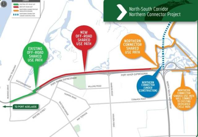
First proposed by the PortBUG in the 2015-20 PA/E ‘Local Area Bike Plan’, and opened in August 2020, the Port River Bikeway runs alongside the Expressway of the same name. It connects the Port’s Inner Harbor Bike Network to major local and longer distance routes including the:
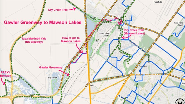
- the Tapa Martinthi Yala Bikeway – connects to the Salisbury Bike Network and routes beyond to Nuriootpa
- the Gawler Greenway – connecting to Mawson Lakes and points beyond to the Gawler Bike Network.

The Port River Bikeway provides essential connectivity between the Port Adelaide/Enfield Bike Network and suburbs to the North and North-East. At night it is lit for its entire length and provides access to the residential and industrial areas adjacent to Grand Junction Road via turn-offs at Eastern Parade, Hanson and South Roads.
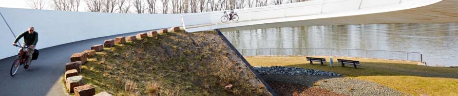
It’s important to note that the first sections of the Port River Bikeway between the Victoria Rd/Nelson Street junction and Eastern Parade, run on an existing kerbside pathway on the southern side of the roadway, including a pathway on the southern side of the Diver Derrick Bridge. The PortBUG anticipates further investment in PA/E Council’s new 2021 Walking & Cycling Plan to improve access to this section of the Bikeway.
It’s also worth noting that an alternative point of access is provided from the off-road bikeway along Perkins Drive just to the east of the Port CBD. We anticipate that the Perkins Drive Bikeway will eventually connect directly to both the Outer Harbor Greenway and the proposed Rosewater Loop Bikeway via a new section of pathway across the Gilman Railyard Reserve.
Access to the Port River Bikeway can be further explored via the Cycle Instead app (see example below).

Updated March 2021.


