
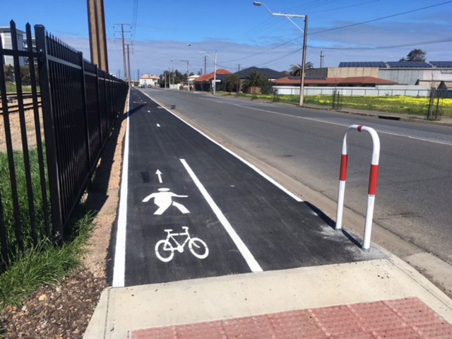
Causeway Rd Bikeway, looking south from Glanville Rail Station.
1. Causeway Road Bikeways: This project (actually part of 2017-18 investment) appears to almost be finished with just line marking and the surfacing of the pathway adjacent to Glanville Station to be finished. It will provide linked off-road bikeways (also for pedestrians and mobility device users) along the entire length of Causeway Road. These new bikeways will be a great step forward for Active Transport use along what is otherwise a hazardous and difficult stretch of road that serves two primary schools and two rail stations, and links two major arterial routes (Semaphore Road East and Bower Road). It is also a designated heavy transport route and currently provides no on-road bicycle facilities at all.Located at it’s southern, Bower Road end is one of Adelaide’s rare bicycle-priority light-controlled crossings, installed at PortBUG’s request a couple of decades ago! Few cyclists seem to know the bicycle-actuated crossing is there. We’ve asked the City of Charles Sturt (who manage things on the southern side of the road) to assess the situation and hopefully the signalled crossing can be given a higher profile once the pathway redevelopment is complete!
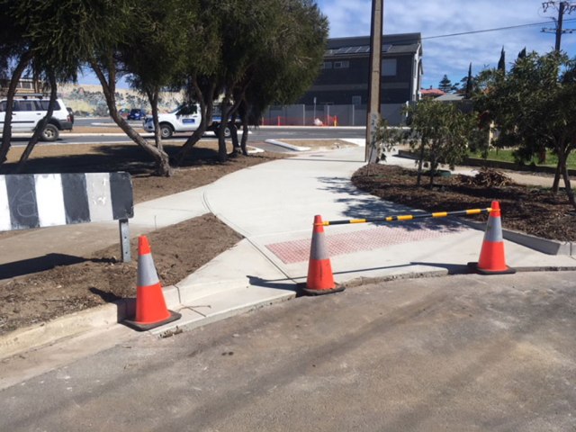
New cut-through, end of Heath St to the junction of Fletcher & Semaphore Roads.
2. Semaphore Road & Heath Street:This local 2017-18 project is also almost complete. It will see a ‘cut through’ at the end of Heath Street, Birkenhead, with improved access across Fletcher Road and a much better pathway along the northern side of Semaphore Road to a revised road crossing adjacent to a much-used bus stop opposite the ‘Big Crocodile’ art-work. This project will make it easy for cyclists to travel directly between Semaphore and Victoria Roads, avoiding need to negotiate the hazardous complex at the junctions of Victoria Rd, Nelson Street, the Port Expressway and Semaphore Road. It will also make things much easier and safer for pedestrians and those dependent on wheel chairs and mobility devices!

New cut-through, looking back up Heath St to Victoria Road.

New ramp and pathway, corner of Fletcher & around the northern edge of Semaphore Rd to the adjacent bus stop and pedestrian crossing.
3. Local Area Bike Plan Projects – 2018-19 Financial Year. Following discussions with the Council late in 2017 PortBUG is able to announce the following Bike Plan Implementation projects for the coming financial year.
3.1. Improvements to the Outer Harbour Greenway – Mead St, Birkenhead: This short off-road stretch of the Greenway route will see a new ramp and ‘stop’ line installed at the corner of Semaphore Road & Mead Street and a new off-road pathway extend down from the corner to Shorney Street where Greenway users will rejoin the roadway. The pathway design is yet to be finalised.
3.2. Enviro Non-Slip/Earthwrap – Coast Park Pathway: This work will see installation of on-path guidance signs for PA/E Coast Park users, similar to those installed on the Charles Sturt section of the pathway to the south. These signs will guide pathway users in appropriate safety etiquette and behaviour – how to pass safely, use of bells etc.
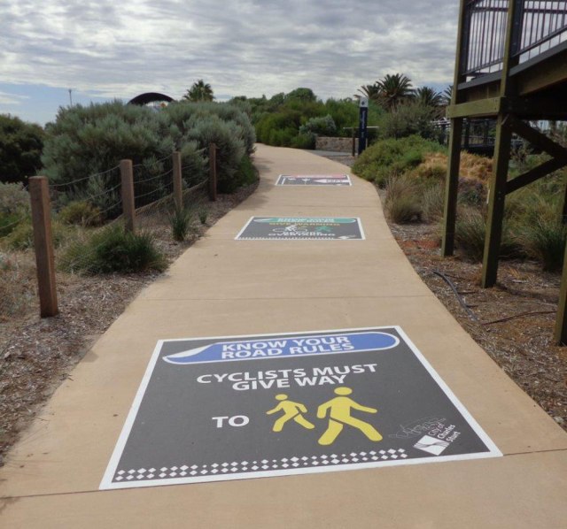
Enviro/Earth Wrap pathway markings (Charles Sturt section at Semaphore Park).
3.3. Pedestrian refuge on the Enfield East-West Bikeway: A new pedestrian refuge on the Enfield East-West Bikeway where it crosses Main North Road between Warwick St & Barton Street.
3.4. OHG Line Marking: New shared-path symbol line marking on the Outer Harbour Greenway, between Nelson St and McLaren Pde along the Inner Harbour wharf. This is DPTI’s preferred bike route linking the Birkenhead Bridge to McLaren and Lipson Streets (Lipson St-South is to be resurfaced so installation of sharrows there will be delayed).
3.5. OHG Line Marking: Sharrow linemarking on the Gawler Greenway at Pym St, Dudley Pk. This relatively short section of Pym Street has proved too narrow for other traffic calming or separation strategies (bike lanes, car park removal etc).
3.6. OHG Line Marking: Sharrow Linemarking on Osmond Tce, Gilles Plains. This is a new ‘mixed traffic’ road in a new subdivision.
3.7. ‘Coopers Link’: This proposed off-road shared-use pathway will run down the reserve on the Northern side of Regency Rd between Narweena Street and South Road. It will connect the E-W Connector bikeway (Gillman Railyards to Days Road) to the Gawler Greenway. There is some uncertainty about implementation due to planned work on South Road but it remains on Council’s plans for 2018-19.
4. Bike Plan Possibilities – 2019-20:
- Greenway Linkage to Coast Path:This is a link from Flaminia St across Lady Ruthven Drv to join up with the Coast Park. It will rely on cooperation with DPTI and resolution of tricky drainage issues.
- Mersey Rd Bikeway:Improvements to off-road pathway and connectivity at Osborne. Works may address the impact of the planned Sub-Corp extension across Mersey Rd, Council’s designated bike route along the western side of the Port RiverRosewater LATM:Detailed plans are being finalised for the
5. Rosewater Local Area Traffic Management Plan (LATM), including designs for a new pedestrian and bicycle rail crossing between Florence and May Terraces. This new crossing will greatly facilitate access between Rosewater and Ottoway and to the shopping facilities on Grand Junction Road. The LATM also includes traffic calming and heavy-vehicle management strategies for Rosewater and a designated on-road bike route paralleling Grand Junction Road.
6. 2019 & Beyond: The Port Adelaide/Enfield Bike Plan concludes in 2020. The community will need to think long and hard about what the next stages of Active Transport development need to be. PortBUG will continue to discuss options with Council for implementing the 2015-2020 PA/E Bike Plan and then developing a new one. The challenge for helping Port Adelaide/Enfield become an ‘Active Transport City’ is constantly evolving, particularly in the face of major State Government projects and commercial housing and industrial development. The Council is already actively considering the major traffic management issues such as those associated with the Port Dock Rail Station, the Dock One & Two housing developments and the extension of the SubCorp site on Mersey Road.
Many changes are coming down the track and the PortBUG will continue to face challenges in asserting the role of cycling in the transport mix and the needs of Active Transport Users. Public consultation and your input to this process will be important. As planning items and proposals come up for public consultation we’ll put them out for comment – please let us know your responses via our Facebook Group or our web page& email when they are posted.


