
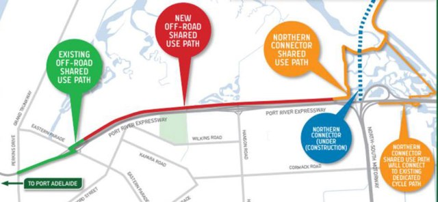
PREXY Bikeway marked in RED.
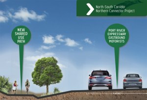
Bikeway profile, looking east.
1. Progress on the PREXY Bikeway. Members of the redoubtable Uncool Cycling & Canoeing Club have alerted us to rapid progress on the long-awaited new bikeway running parallel to the Port Expressway (the ‘PREXY’) – see the very encouraging photo below. Over the past 2-3 years we have covered the development of the PREXY Bikeway and it’s various connections as information has come to hand – some informative links to relevant blog posts below (with extracts).
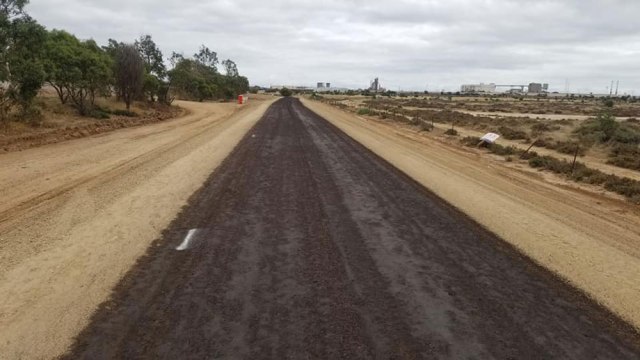
Newly surfaced PREXY Bikeway, looking west (Photo: UncoolC&CC).
September 2018 “The new off-road path will connect the existing path off Eastern Parade in Port Adelaide to the Northern Connector path. It will run side-by-side with the Port River Expressway and is expected to be completed by the end of 2019. Once it is up and running, cycling on the Port River Expressway between Port Adelaide and the Superway will be banned… It will connect to the new Northern Connector [NEXY] Bikeway as well as the Gawler Greenway so it will provide connectivity to Salisbury as well as Gawler and to suburbs along the way such as Mawson Lakes etc.”
 November 2019 “Both the PREXY & NEXY will eventually have their own Greenway bike paths which will connect to the Gawler Greenway via an underpass under the Port Expressway and pathways through the wetlands on the southern side. The Gawler Greenway will eventually extend all the way to Gawler, following the alignment of the Gawler rail line.”
PREXY Bikeway access at the western ‘harbor’ end remains a tad unclear but we believe will be at or close to the PREXY’s intersection with Eastern Parade.
Edit – Further Notes: Recent conversation with DPTI staff has provided a bit more information about the PREXY Bikeway now under construction:
- The section from Eastern Parade to Perkins Drive is close to completion – note the green concrete on southern side of the road.
- The connection from Eastern Parade [to the PREXY Bikeway] remains as is, at the signalised crossing but with a better path alignment off Prexy.
- [During construction] …there’s a detour off PREXY between Hanson and Kidman Road using part of the Gawler Greenway and Cormack Road to avoid people cycling within the construction site.
- The general alignment plan is as per the Port Adelaide Bicycle Forum’s header photo on the facebook (see top of post). The only update to this is to the very right (eastern end) which has already been connected to the next bit of Gawler Greenway via Magazine Road (not yet open).
- No completion date as yet.
Note that DPTI staff caution cyclists seeking to enter or inspect the site – it remains an active construction zone & is unsuitable for public access!
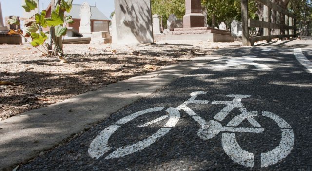
Closure: The Linear Path adjacent to the Hindmarsh Cemetery.
2. Closure of the Linear Path Underpass at South Road: Charles Sturt Council have announced the commencement of work to upgrade the Linear Path underpass at South Road. They say: “The South Road Underpass and River Torrens Linear Park Path (RTLP) adjacent the Hindmarsh Cemetery has been identified for renewal in the City of Charles Sturts Transport Asset Management Plan.”
“In January 2020 signage was installed along the River Torrens Linear Park (RTLP) path notifying users that construction of the new path and bridge structure will commence in [mid]March 2020… with an estimated completion date of approximately December 2020.
“During the works there will be localised traffic management on Adam Street between River Street and South Road… access to the Carpark on the corner of Adam Street and River Street will [be closed] during construction as it will be the location of the Contractors site office. … Detours for bike riders will be enforced during this time.”
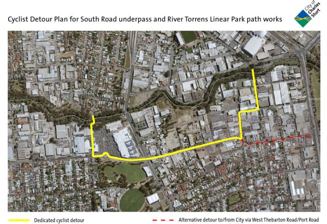
For updates and to view the detour map refer to the CCS website. Construction enquiries: Carmine D’Amico, 8408 1189.

The Pinda Street Greenway detour – ‘Bianco Site’ on the right.
 3. Outer Harbor Greenway – Kilkenny. Charles Sturt Council have announced a rezoning proposal for land behind the Kilkenny Rail Station and between Wilpena Street and McInerney Reserve, also known as ‘the Bianco site’. The Council has had a long-standing arrangement to ensure a section of this site behind the station is reserved for an extension of the Greenway between Wilpena Trc and the Reserve.
 This new pathway will provide direct access between the David Trc road crossing and McInerney Reserve, avoiding the current detour via Wilpena Trc, Pinda Street and the Reserve pathways. The relevant DPA proposals are to “ensure pedestrian connections to MJ McInerney Reserve and the station platform” & “allow for the location of the Outer Harbour Greenway through the subject land, adjacent to the railway corridor.” More details here.
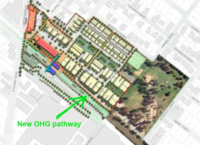
From the DPA showing the new OHG Path.


