

1. AdaptWest Community Climate Change Survey: Jeremy Miller, AdaptWest Climate Change Coordinator (Councils of Charles Sturt, Port Adelaide/Enfield & West Torrens) is undertaking a Community Climate Change Survey.
The survey runs for three weeks and is open to anyone who lives and/or works in Western Adelaide. Please consider responding ASAP!
2. R2P Bike Overpass Opens: A new pedestrian and cyclist overpass – part of the Regency Road to Pym Street (R2P) Project – has officially opened to the public!
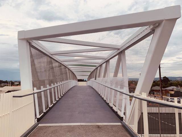
The overpass provides important east-west connectivity for the PA/E Council’s East-West & Parks Connector commuter & local bike routes. It connects these routes to the Gawler Greenway route into the Adelaide CBD and spans 57m over the North-South Motorway. Minor finishing works will continue on the overpass for the coming months with the overpass remaining open during these works.
The Project will be conducting bus & walking tours of the new overpass & project this coming Sunday 21st March between 10am & 12. Details & bookings here – registration & bookings are essential.
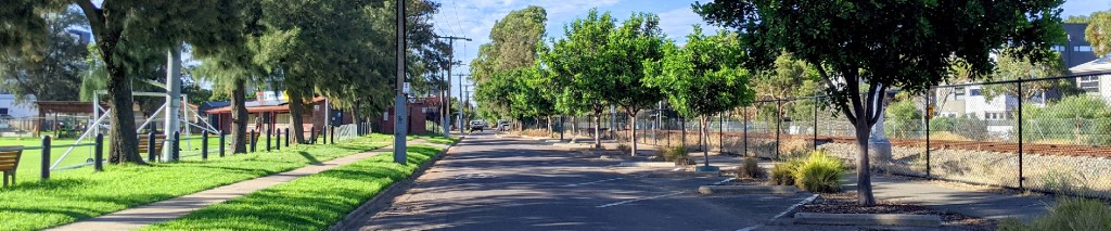
3. Guide to the Port River Bikeway: The PortBUG’s website now has a page providing information about the Port River Bikeway (see red & green labels below). Check it out here.

4. Devonport Upgrades: Prospect Council is proposing streetscape & traffic management upgrades to this key section of the Gawler Greenway. Read about the plans here.
5. Meetings with Council: PortBUG is currently meeting with PA/E Council to discuss several key sets of issues, notably:
- the development of the Council’s new Walking & Cycling Plan
- the Council’s Post-COVID Recovery Project.
We’ll keep readers informed of the outcomes of these discussions via the BugBlog and at our facebook group, the Port Adelaide Bicycle Forum.
6. Bicycle Network Analysis for Port Adelaide! The US-based Bicycle Network Analysis has recently been launched in Australia with trial assessments of the CBD Council areas in state capitols (the Adelaide CBD achieving the 3rd lowest score!)
Four further local area assessments will be conducted in South Australia over 2021, including the Port Adelaide/Enfield Council. The BNA generates a number of useful reports including:
- a Network Cycling Stress Map – a graded continuum of route stress ratings
- a Connectivity Map, identifying access to local destinations across the chosen area
- an Infrastructure Map, identifying cycle routes
- a Numerical Score based on cycling access to a range of key destinations and services.
You can now listen to an audio recording about the BNA at www.weride.org.au/BTA We’ll keep readers updated on outcomes of Port Adelaide/Enfield’s BNA survey when it becomes available.
Adelaide CBD’s BNA Map & Bikeability report


The R2P bridge is very cool. In the UK we are way behind with such stuff. Well done you lot.
LikeLike